Big Walk Island Map & Navigation
No minimap, no GPS line — plan routes in the map room, read landmarks, and regroup when glorious wandering goes too far.
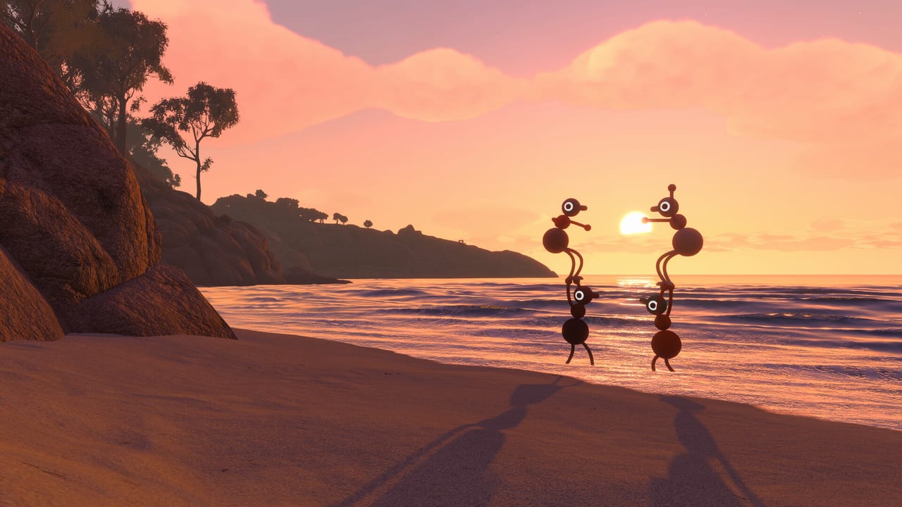
Big Walk’s island is handcrafted, not procedurally generated noise. House House wants you lost together — not frustrated alone. There is no minimap, no glowing objective trail, and no universal GPS ping chasing you across hills. Instead you get overlooks, paper maps, a central map room, landmarks you can see from valleys, and tools like flares and binoculars that turn navigation into a cooperative skill. This hub explains how to orient as a group, why the map room matters, and where to go when someone disappears into fog.
Read Map Room & Paper Maps for cartographer roles and overview habits, then Landmarks & Getting Unlost for regroup tactics and flare discipline. Pair with Gestures & Arms because silent recovery depends on both sight and input vocabulary.
Design philosophy: intentional wandering
GameSpot’s review noted switchbacks down mountainsides that hint at far-off landmarks, radio stations with distinct songs you can carry, and shortcuts that feel earned because no HUD arrow handed them to you. Polygon described the open world as naturalistic terrain dotted with bright playground-like structures — easy to spot from ridges, easy to agree on as meeting points.
That design supports online co-op for 2–12 players with proximity voice: when someone drifts out of audio range, you still need visual anchors. Navigation is therefore a social mechanic tied to Multiplayer Hub etiquette, not a solo checklist.
The map room and session start
Many sessions begin near a large map and tutorial-adjacent planning space — reviewers mention returning there when the host resumes a save. Treat it as your table: gather before sprinting into forests, mark mentally which region you aim for (coast, highlands, caves), and decide who carries binoculars, flares, and walkie-talkies.
The map room reward unlocks as part of progression; until your host’s save reaches it, rely on overlooks and coastal towers. Host progress gates what shortcuts exist — see Host Saves so guests understand why a bridge your friend mentioned is not open on night one.
Paper maps and backpack co-op
Inventory is physical. Maps may live in a backpack you cannot open alone — a partner removes your pack so you can unfold paper on the ground. That detail from previews encapsulates Big Walk: navigation is literally a two-player action sometimes.
Assign a navigator role each session who carries the map, reads terrain, and calls landmarks. Rotate the role so one person does not burn out on responsibility. PC players with fast item swap excel; console players with clear voice excel — pick based on strengths.
Island regions at a glance
Without spoiling every puzzle name, expect biome shifts that change navigation rules:
Coastal arrival and towers: Early binocular views teach sight-line navigation. Lookout towers function as air-traffic control for ground teams.
Forests and fog: Paths loop; visibility drops. Watchtower spotters with laser pointers become critical.
Highlands and mountains: Long sight lines return; wind and elevation make voice harder — use megaphones or flares.
Caves and underground networks: Proximity voice echoes and muffles; gestures and radio tools replace shouting.
Central hubs and sundials: Major regions connect at memorable landmarks — sundial-style structures appear in walkthrough notes as orientation anchors.
Exact names evolve with host progress; this hub focuses on methods, not a spoiler chart of every gate.
Tools that extend the map
Navigation items complement paper and the map room:
| Tool | Navigation use |
|---|---|
| Binoculars | Spot landmarks, teammates, distant puzzles |
| Laser pointer | Mark routes on cliffs and walls |
| Signal flares | Sky beacon for regroup — see landmarks page |
| Walkie-talkie | Voice when proximity chat fails |
| Lantern / flashlight | Night paths and upward light columns |
| Whiteboard | Sketch plans when maps lag behind exploration |
Tool locations vary by host save state; prioritize finding binoculars and flares early. Wiki tool pages under /tools/ expand pickup routes when published.
Routing workflow for a typical session
- Meet at map room or spawn overlook — confirm today’s goal with voice.
- Assign navigator and spotter — navigator reads map; spotter takes binoculars.
- Pick a visible landmark chain — “tower → red bridge → sundial” not “go north.”
- Set a regroup rule — flares every thirty seconds if separated, or both arms up at agreed rock.
- Move in pods — split into two-to-four player teams max unless puzzles require more spread.
- Update the map physically when discoveries unlock shortcuts — trains, lifts, tunnels.
Skipping step four causes most “lost for thirty minutes” stories that are funny in retrospect but costly mid-session.
Crossplay navigation notes
Mixed Steam, PS5, and Switch 2 parties should connect via Join Codes before debating routes. Switch players with weaker voice need clearer landmark names everyone repeats the same way — “the big yellow slide structure” beats “that thing over there.”
Hosts on any platform carry the unlocked shortcuts; guests rejoin the host’s geography each session via Crossplay Platforms.
What the map deliberately withholds
No player-position dot on a minimap means you cannot silently cheat friends by reading HUD alone. You must describe location, point with arms, or mark with tools. That aligns with proximity chat as a core system from Online Requirements.
Shortcuts like ski lifts or underground tunnels reward persistence; when a lift passes without you, laser pointers and flare schedules recover the group faster than blame.
When you are gloriously lost
Getting lost is a feature until it is not. Escalation ladder:
- Stop moving; use voice if in range.
- Left/right arm point from high ground.
- Walkie-talkie check-in on agreed channel.
- Coordinated flare pattern toward last known landmark.
- Navigator opens paper map with a friend’s help at a safe camp.
Full detail: Landmarks & Getting Unlost.
Related wiki pages
Communication: Controls Hub, Gestures & Arms. Connection: Join Codes Hub. Co-op roles: Multiplayer Hub. Emergency beacons: flare sections in Landmarks and future Tools guides.
Frequently Asked Questions
Quick answers to the most common Big Walk questions.
Does Big Walk have a minimap?
No. Navigation relies on landmarks, paper maps, the map room, tools like binoculars, and team communication instead of a constant HUD arrow.
Where is the map room?
It unlocks as the host's save progresses and sits near common session start areas. Early sessions rely on coastal towers and overlooks until then.
Can one player read the map alone?
Sometimes maps live in backpacks another player must open for you — navigation can require cooperative inventory help by design.
How do we plan routes in crossplay?
Meet at spawn or map room, agree on visible landmark names, assign a navigator, and share Join Codes before splitting up.
What is the best regroup tool?
Signal flares visible across the island are the classic emergency beacon; pair with a timed flare schedule described on the Landmarks page.
Does the island change per player?
The world is handcrafted and consistent, but which shortcuts are open depends on the host's save progress.